Storm Austen cuts power to nearly 7,000 homes and disrupts travel
Schools shut and flights and trains were cancelled as Storm Austen hit southern Britain, with another Atlantic storm due tomorrow.

By Marcus Odell, Political Correspondent
Published 23 Oct 2026, 07:01
What happened
Nearly 7,000 homes in Cornwall lost electricity as Storm Austen brought damaging winds and heavy rain to Britain, interrupting school opening and cancelling journeys by air and rail. The South West bore the greatest impact, with the area around Penzance among the places hardest hit by power cuts.
The strongest gusts recorded this morning reached 76mph on both the Isles of Scilly and Guernsey. Jersey recorded 72mph, while Culdrose in Cornwall registered 71mph. Forecasters had warned that exposed parts of South West England could experience gusts reaching 80mph, with winds of 60mph to 70mph expected more widely across the region.
Some schools in Cornwall shut for the day, while others delayed opening because of safety concerns. In the Channel Islands, the Government of Jersey directed every school and college on the island to close, extending the disruption beyond individual decisions by headteachers.
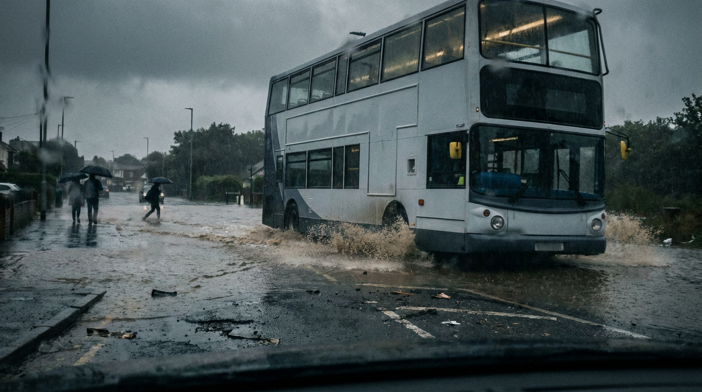
Motorists in Devon and Cornwall were urged to restrict journeys to those that were necessary. Overturned vans, fallen trees, loose debris and power cables brought down by the wind created hazards, while flooding left some roads impassable. The conditions affected both access to destinations and safety along the route.
Floodwater spread across roads at Wallisdown in Bournemouth, Dorset, during the early morning. In Falmouth, Cornwall, fallen branches surrounded a parked car. The scenes illustrated the combination of surface flooding and wind damage confronting travellers as the morning began.
FlightRadar24 data showed 19 flight cancellations at London Heathrow Airport, 17 at Gatwick, 13 at Southampton and four at Exeter. Those figures amounted to 53 cancellations across the four English airports, adding aviation disruption to the problems facing motorists and rail passengers.
Jersey Airport cancelled its entire morning flight programme because of a red wind warning, affecting 25 services. That closure of the morning schedule came alongside the island-wide education shutdown as strong winds swept across the Channel Islands.
Seven rail operators warned of storm-related disruption: South Western Railway, Southern, Thameslink, Great Western Railway, Northern Rail, CrossCountry and Gatwick Express. Their warnings covered regional, long-distance and airport services, making the effects relevant to passengers travelling well beyond the worst-hit coastal areas.
The background
Austen reached the UK at about 10pm last night and is the first named storm of the season. Its arrival brought the first spell of stormy weather to southern Britain this season, with strong winds coinciding with the start of the working and school day.
The Met Office placed Cornwall, Devon and the Isles of Scilly under an amber wind warning from 1am until 10am. That warning covered the period of greatest concern in the South West, while the broader timetable of warnings associated with Austen extended until midnight tonight.
The storm developed through explosive cyclogenesis, the rapid strengthening of an area of low atmospheric pressure. Often described as a weather bomb, the process meets the stated threshold when central pressure falls by at least 24 millibars over 24 hours. The term describes the system's development rather than a measured wind speed at a particular place.
Met Office senior operational meteorologist Marco Petagna put Austen's pressure fall at 24 millibars in just 18 hours, taking it from 1,004 to 980 millibars. That rate of change placed the system within the explosive-development threshold before a full day had elapsed.
A second Atlantic low-pressure system, Storm Boelo, is also undergoing rapid intensification. Its pressure is forecast to fall from 999 to 948 millibars over 24 hours, a reduction of 51 millibars. The two storms are separate systems, rather than successive names for the same weather event.
What people are saying
Met Office chief forecaster Neil Armstrong highlighted the particular risk posed by trees still carrying their leaves. He warned that branches and whole trees could fall across roads and railway lines, and urged extra care during Friday morning's travel as the first stormy conditions of the season moved through.
The Met Office also warned that airborne debris and damage to buildings were likely, including the possibility of roof tiles being dislodged. Its assessment extended beyond transport delays to hazards around homes and other properties exposed to the strongest winds.
At the coast, forecasters identified a potential danger to life from large waves. Material lifted from beaches could be thrown on to coastal roads, seafronts and nearby buildings, creating risks beyond the water's edge and affecting people using exposed routes or occupying waterfront properties.
The forecaster's assessment also included possible interruptions to mobile phone coverage. Alongside the electricity failures already affecting Cornwall, that raised a separate concern about communications during the storm, particularly when people needed to check journeys or make contact with others.
The Met Office attributed Boelo's expected strengthening to an active jet stream as the system crosses the Atlantic towards Northern Ireland. Its forecast therefore points to another period of unsettled weather following Austen, rather than a straightforward return to settled conditions once today's storm moves away.
What happens next
Austen is expected to move eastwards and pass into the North Sea tonight. Wind gusts should gradually weaken during the day, although spells of heavy rain remain part of the storm's passage. The easing forecast follows the strongest overnight and morning conditions in the South West.
Attention will then turn to Boelo, which is due to arrive tomorrow. Met Office warnings for that system begin at 6pm tomorrow and continue until 9pm on Sunday. The warning period puts the next phase of disruption risk into the weekend, after today's difficulties with work and school travel.
The two warning timetables have different endpoints: midnight tonight for Austen's warnings and Sunday evening for Boelo's. For anyone planning a later journey, that distinction matters because the expiry of a warning for one storm does not describe the conditions expected as the next system approaches.
Likewise, a forecast pressure fall and a local gust measurement answer different questions. Boelo's projected 51-millibar reduction describes its intensification over the Atlantic; Austen's readings from the Isles of Scilly, Guernsey, Jersey and Culdrose describe winds experienced at those locations. The pressure figures are not local wind forecasts.
Why this matters
For households, the disruption combines problems that would ordinarily be dealt with separately: electricity failures, altered school arrangements and difficult journeys. A delayed school opening is different from a full-day closure, so the arrangements applying to an individual school remain important for parents organising the day.
For travellers elsewhere in the UK, the consequences are not confined to living within a wind-warning area. Disruption to long-distance trains and flights can affect a journey whose starting point is outside the strongest winds, particularly when it includes an airport connection or more than one transport operator.
Reporting that informed this story
This article was written independently by The Daily Times from publicly available facts and headlines. No text has been copied from the outlets above.